THE NORTHEASTERN OHIO RAILROAD HISTORICAL SOCIETY
Erie RR Kent OH Car Shops
(Open thumbnails in new windows for higher resolution versions)
Sally Burnell Collection
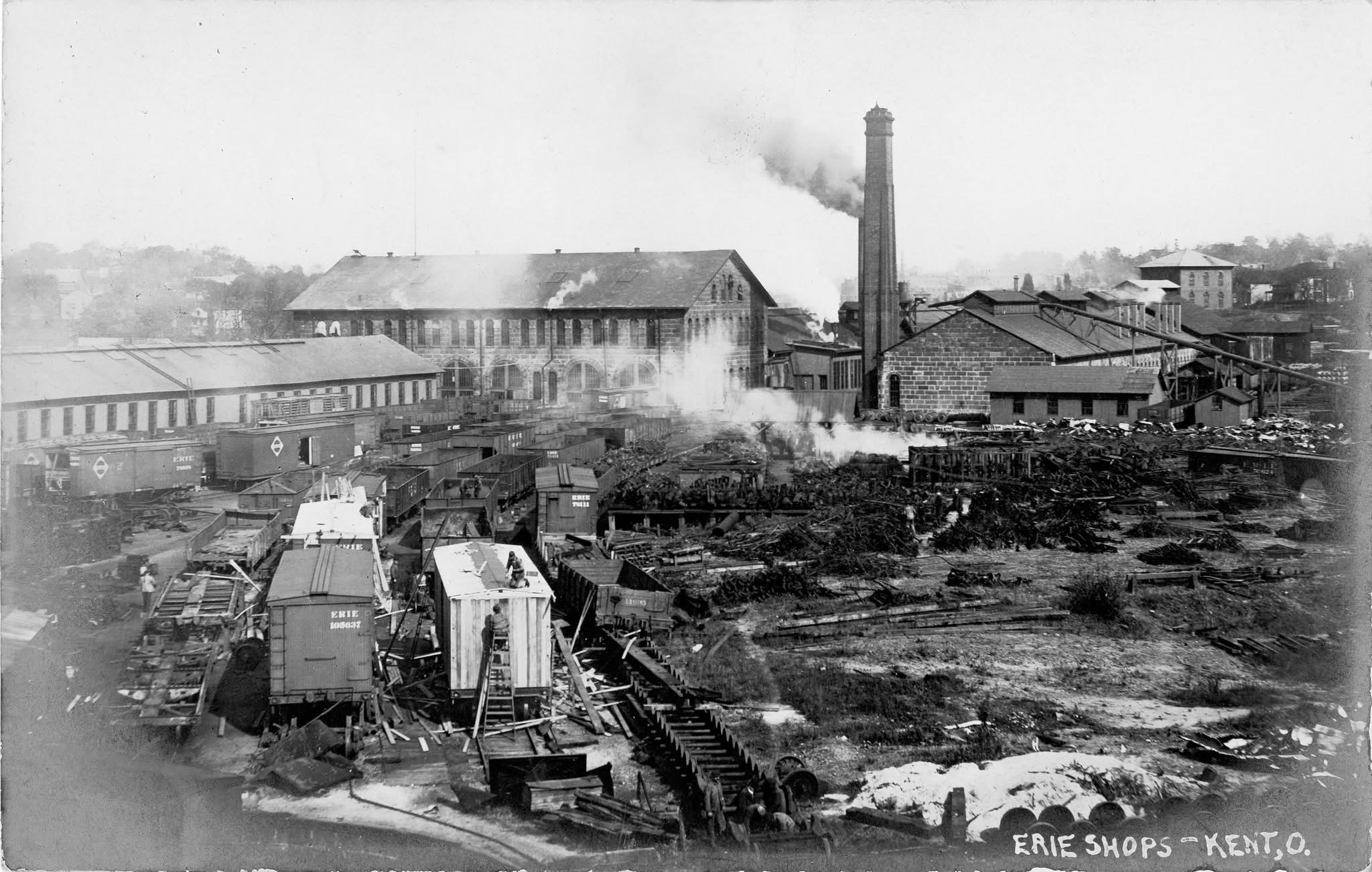
Distant view looking south at rail yard (not sure if A&GW RR or Erie RR era).
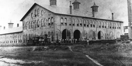
"Head Building" (2 story, no longer standing), circa 1900 looking northeast, Erie RR era.
Western long section attached to "Head Building" looking south (believe no longer standing), not sure if A&GW RR era or Erie RR era.
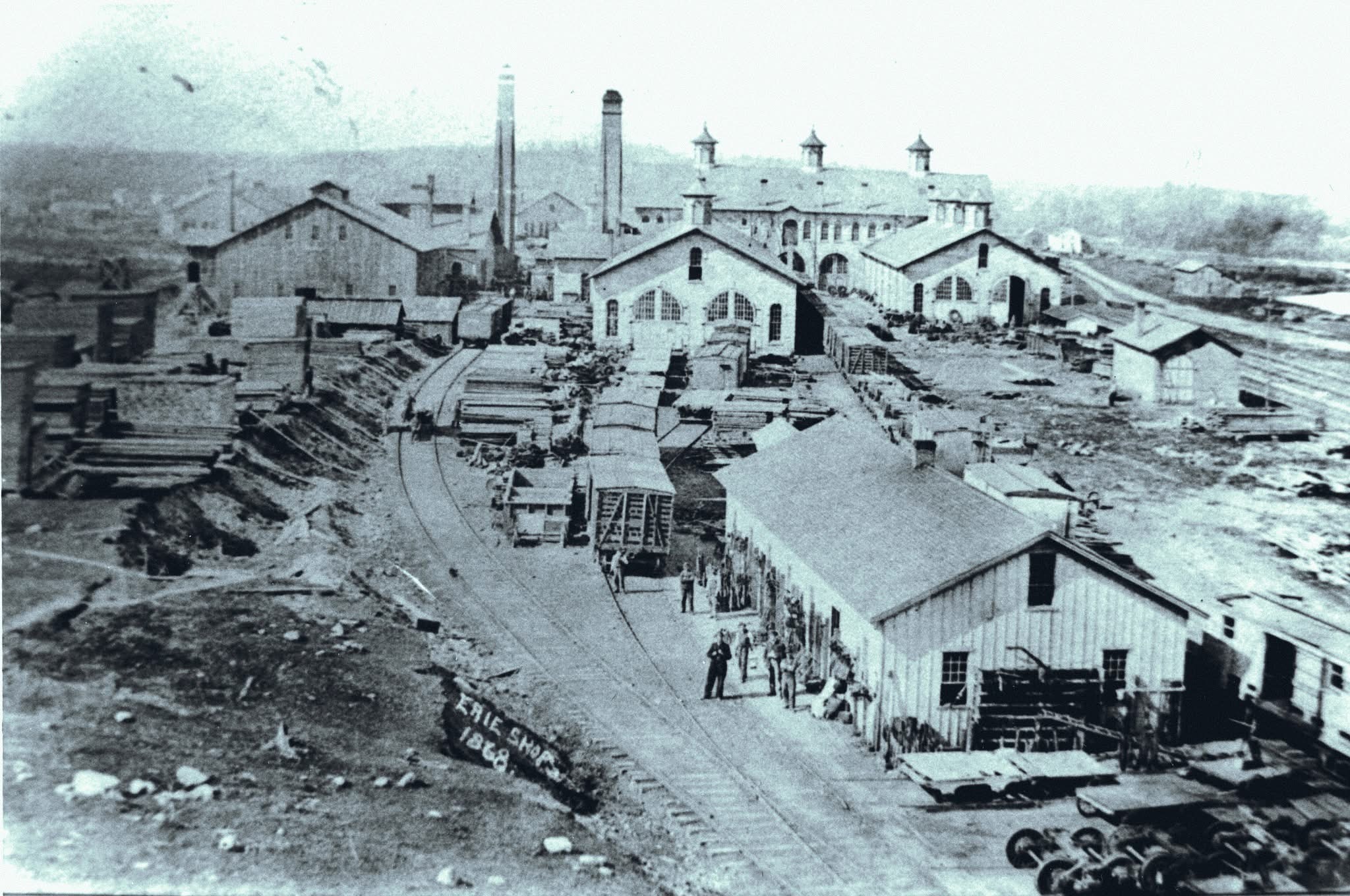
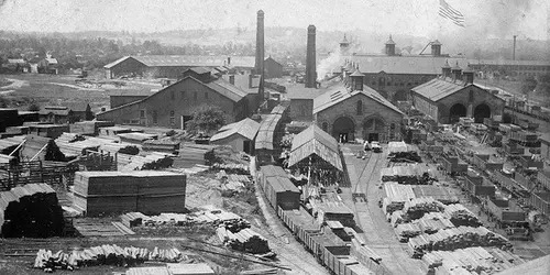
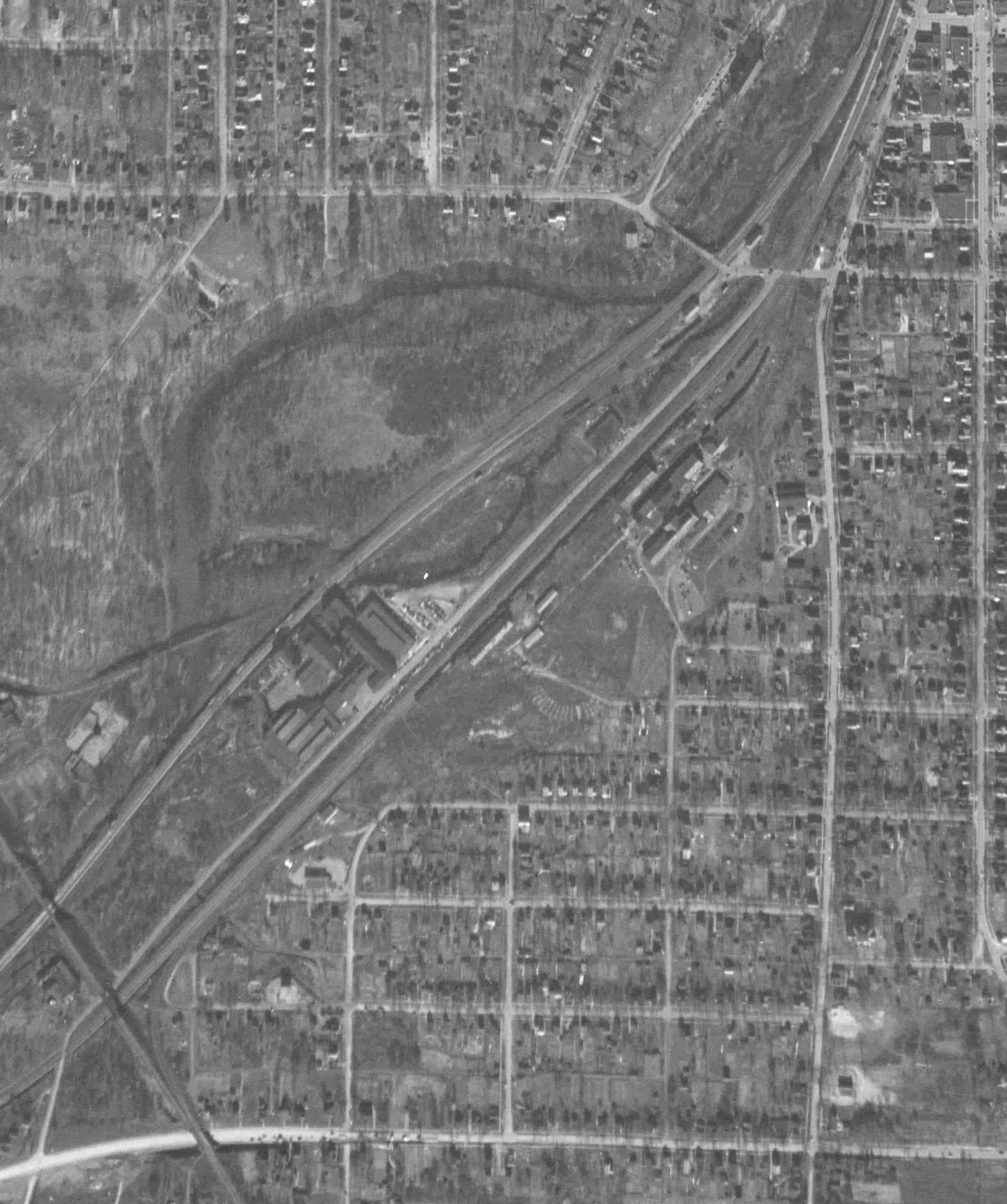
Circa 1868 per date aerial view of yard looking south, A&GW RR era based on date on photo.
Circa 1900? Looking northwest. Center left is Head Building. Erie RR era.
View looking south of planing shop still standing, center right. Circa 1900?
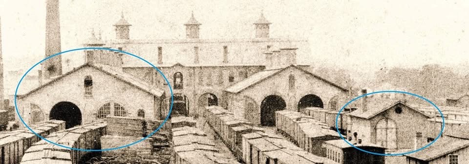
Looking south. Two buildings circled: left is standing and was the planing shop. Right circled no longer standing. Refer to Sanborn insurance maps for more detail. Erie RR or A&GW era?
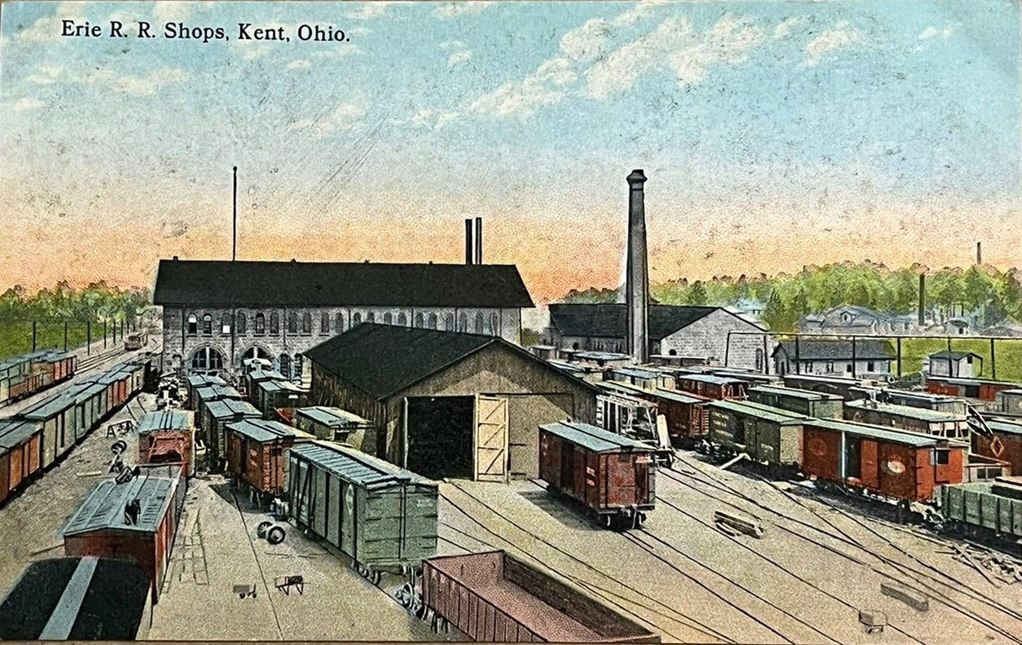
Postcard image (colorized) Erie RR era looking north, circa 1900?
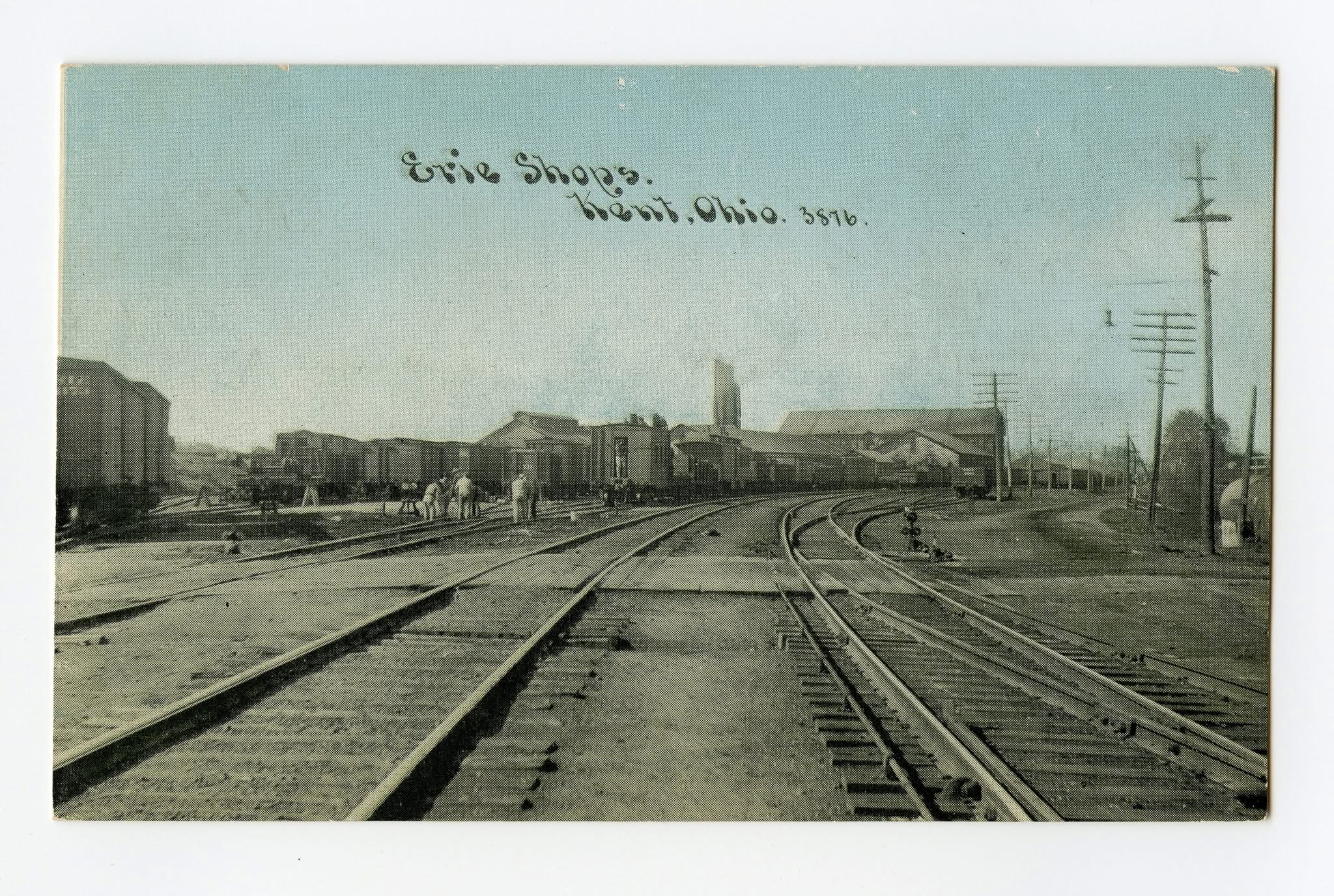
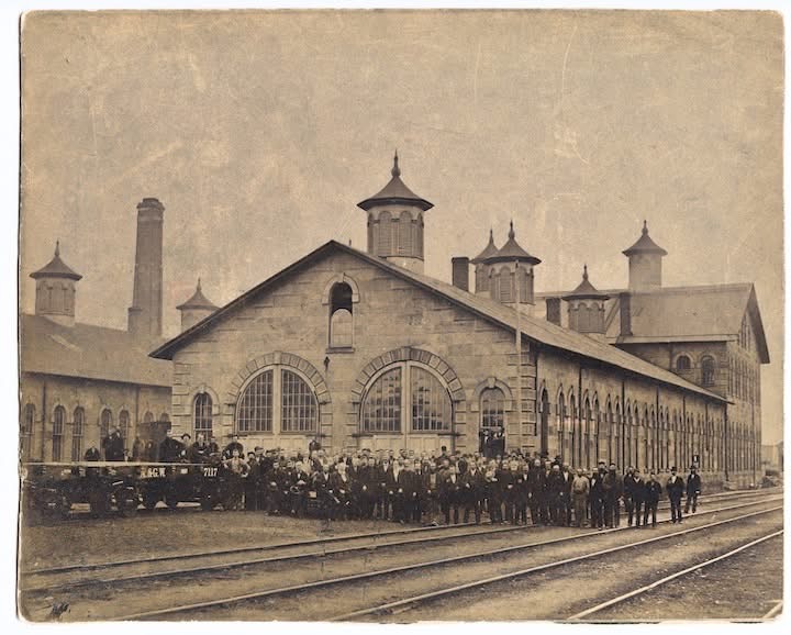
Postcard, looking north, circa 1900. On the right is a side view of the Head Building which had steeples. Erie RR era.
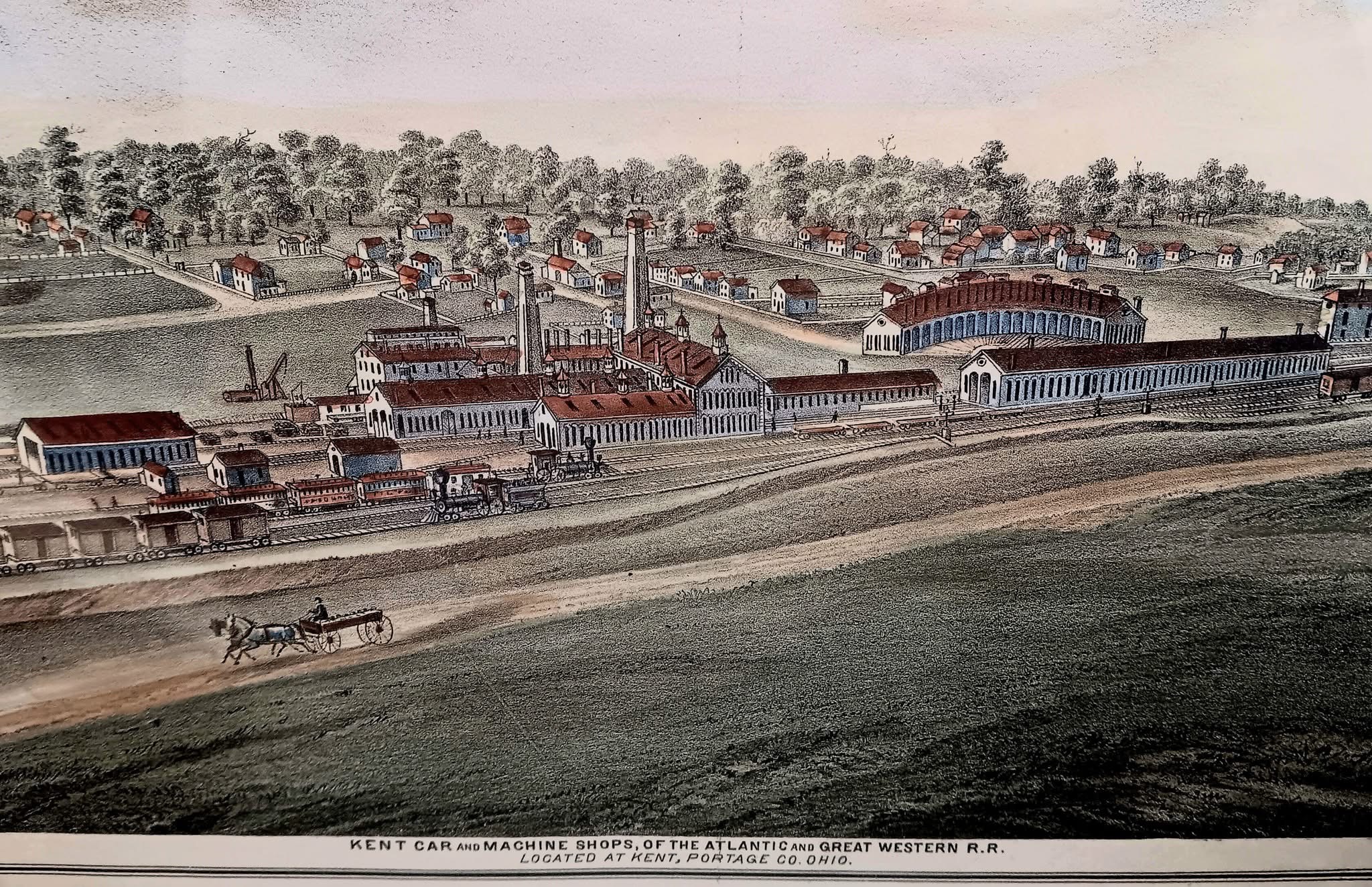
1874 lithograph of the Atlantic & Great Western RR shops that was created for the Centennial Atlas of Portage County.
Kent Building Division
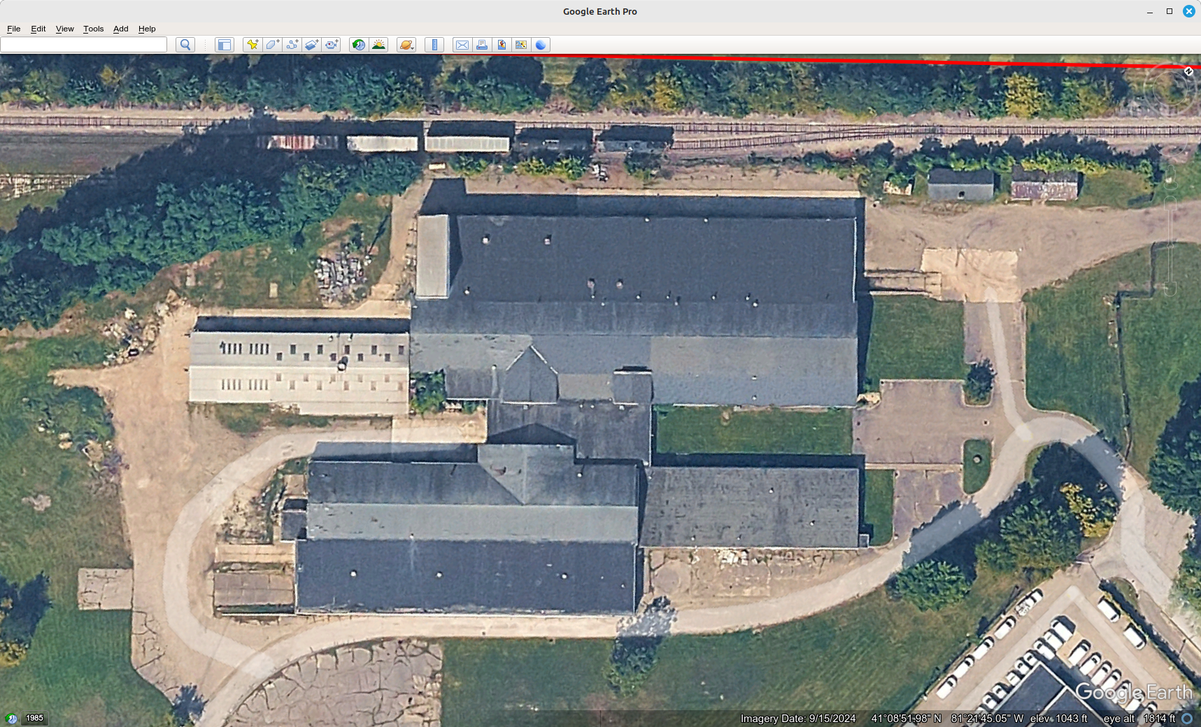
Google Earth layer screenshot 4-2-2026
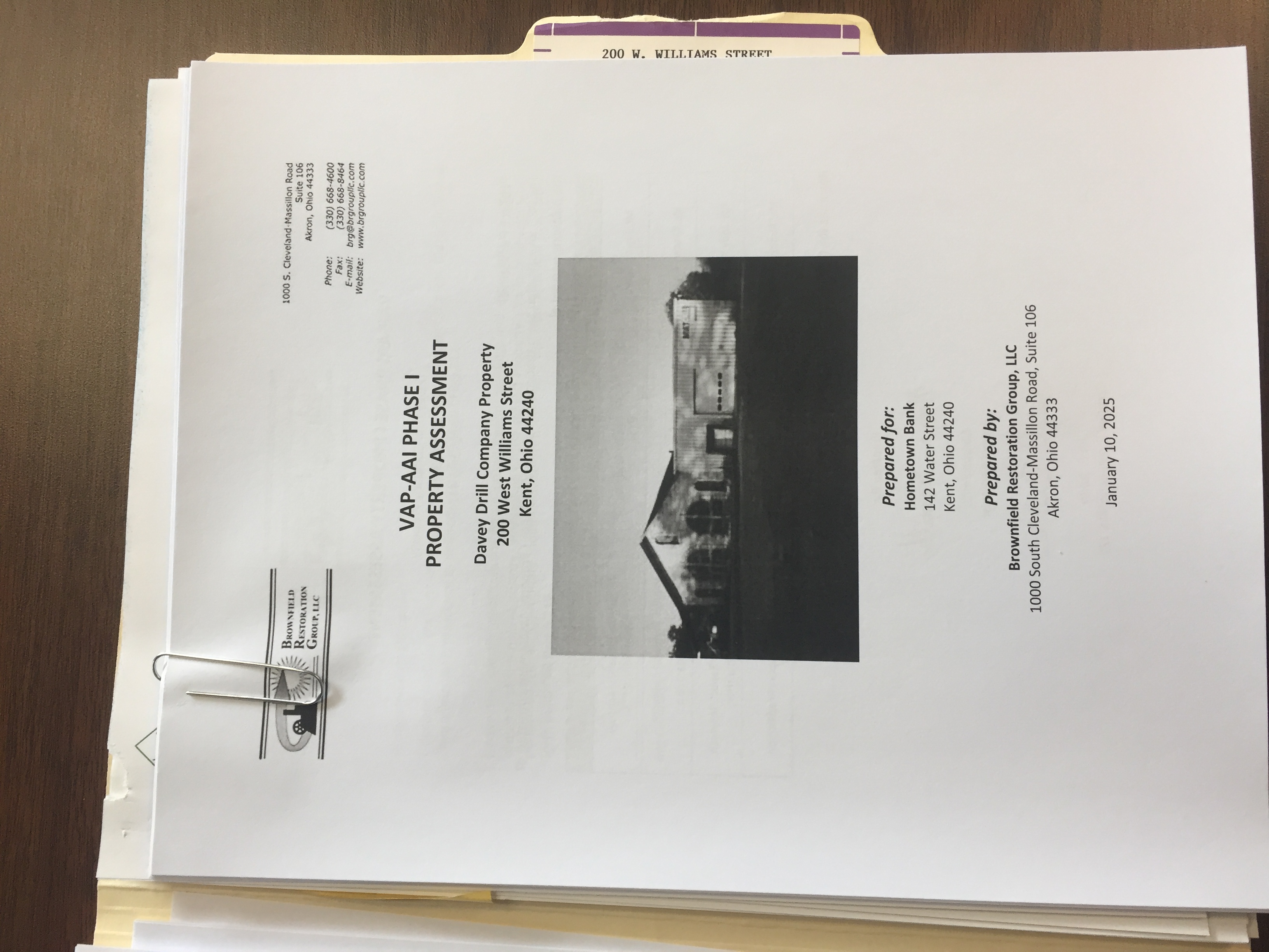
VAP-AAI Phase I Property Assessment cover page
Davey Drill Company Property
200 W. Williams St.
Kent, OH 44240
Prepared for: Hometown Bank
Prepared by: Brownfield Restoration Group, LLC
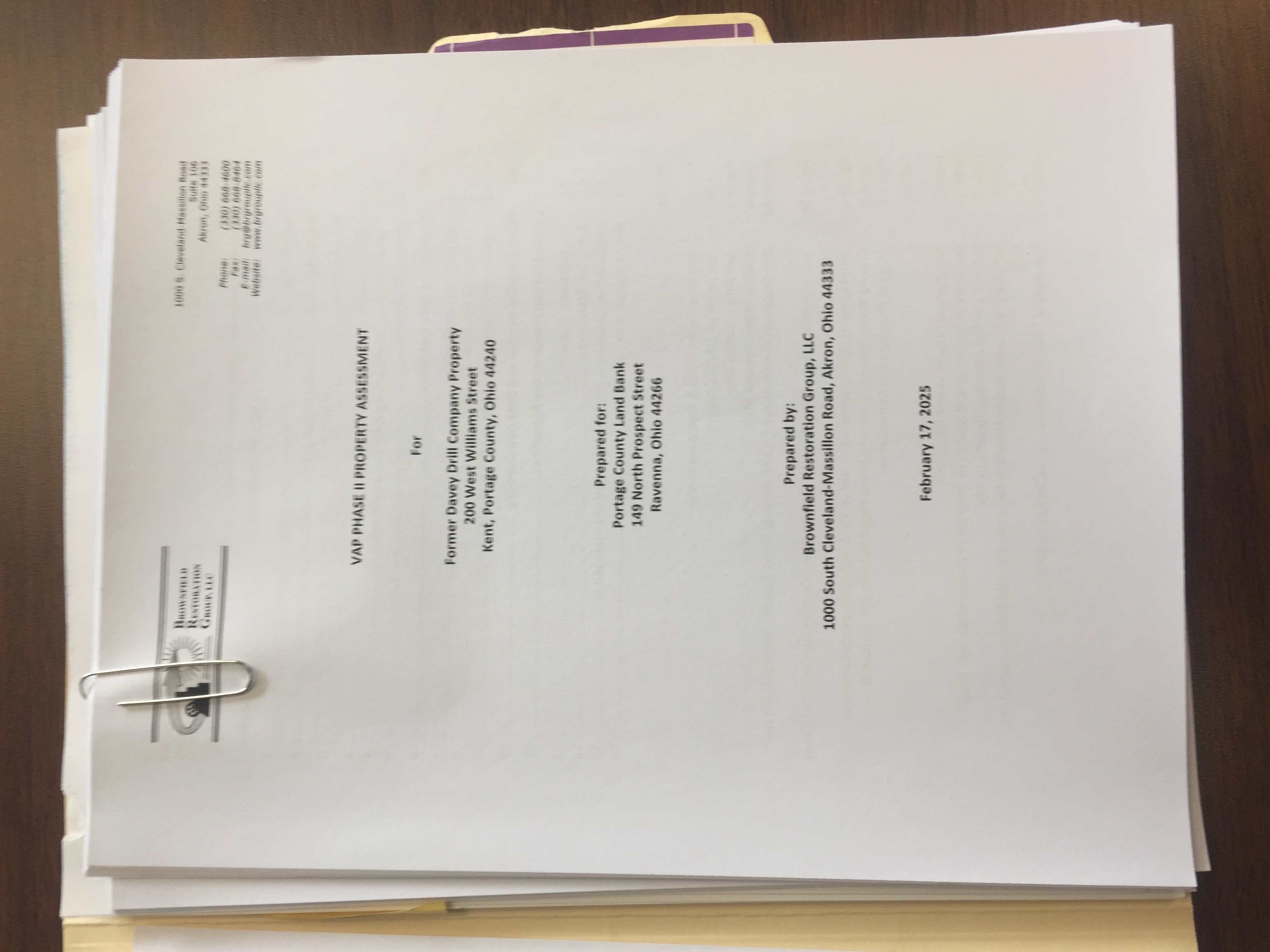
VAP-AAI Phase II Property Assessment cover page
Former Davey Drill Company Property
200 W. Williams St.
Kent, OH 44240
Prepared for: Portage County Land Bank
Prepared by: Brownfield Restoration Group, LLC
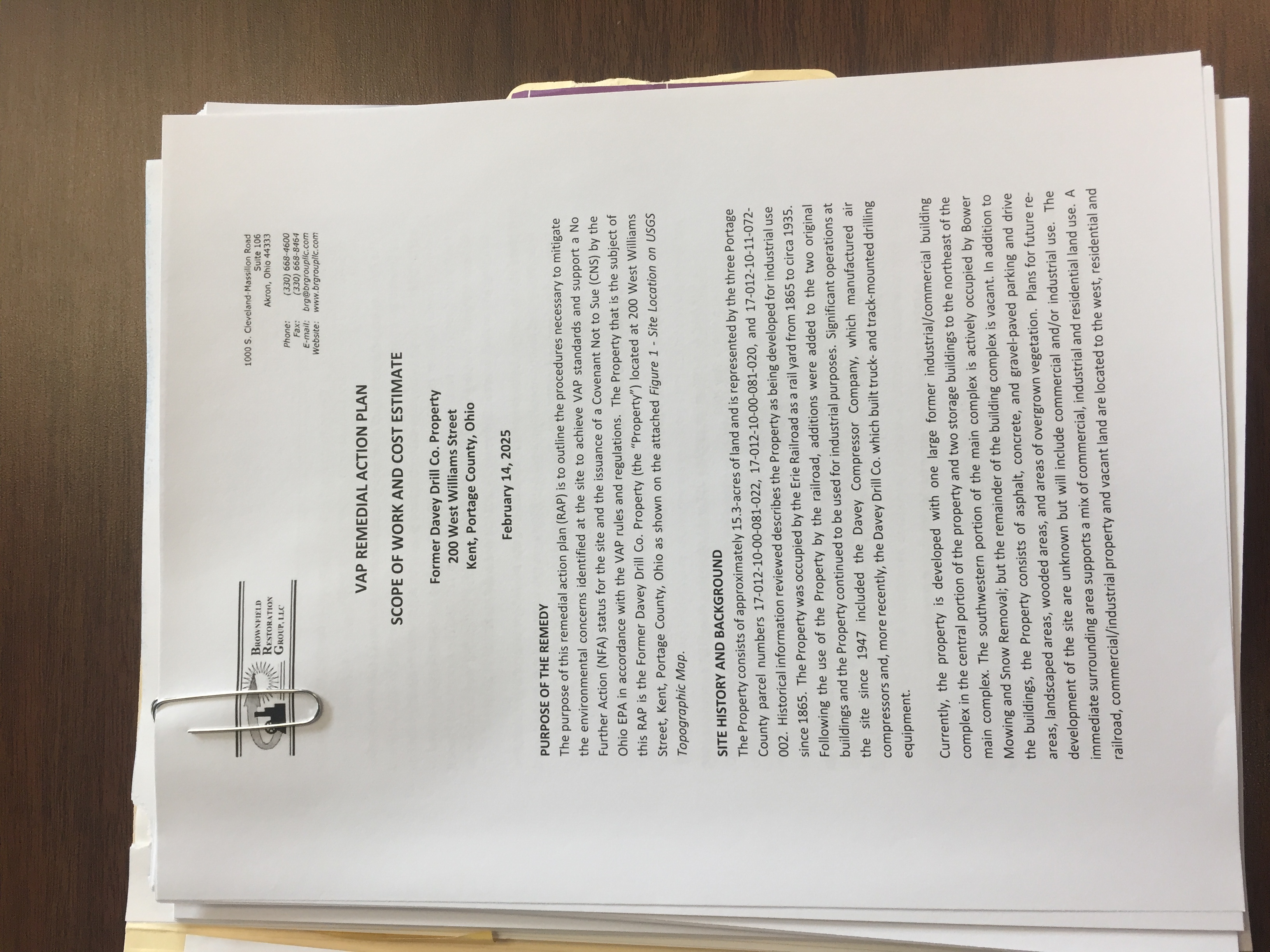
VAP Remedial Action Plan: Scope of Work and Cost Estimate cover page
Former Davey Drill Company Property
200 W. Williams St.
Kent, Portage County, OH
Brownfield Restoration Group, LLC
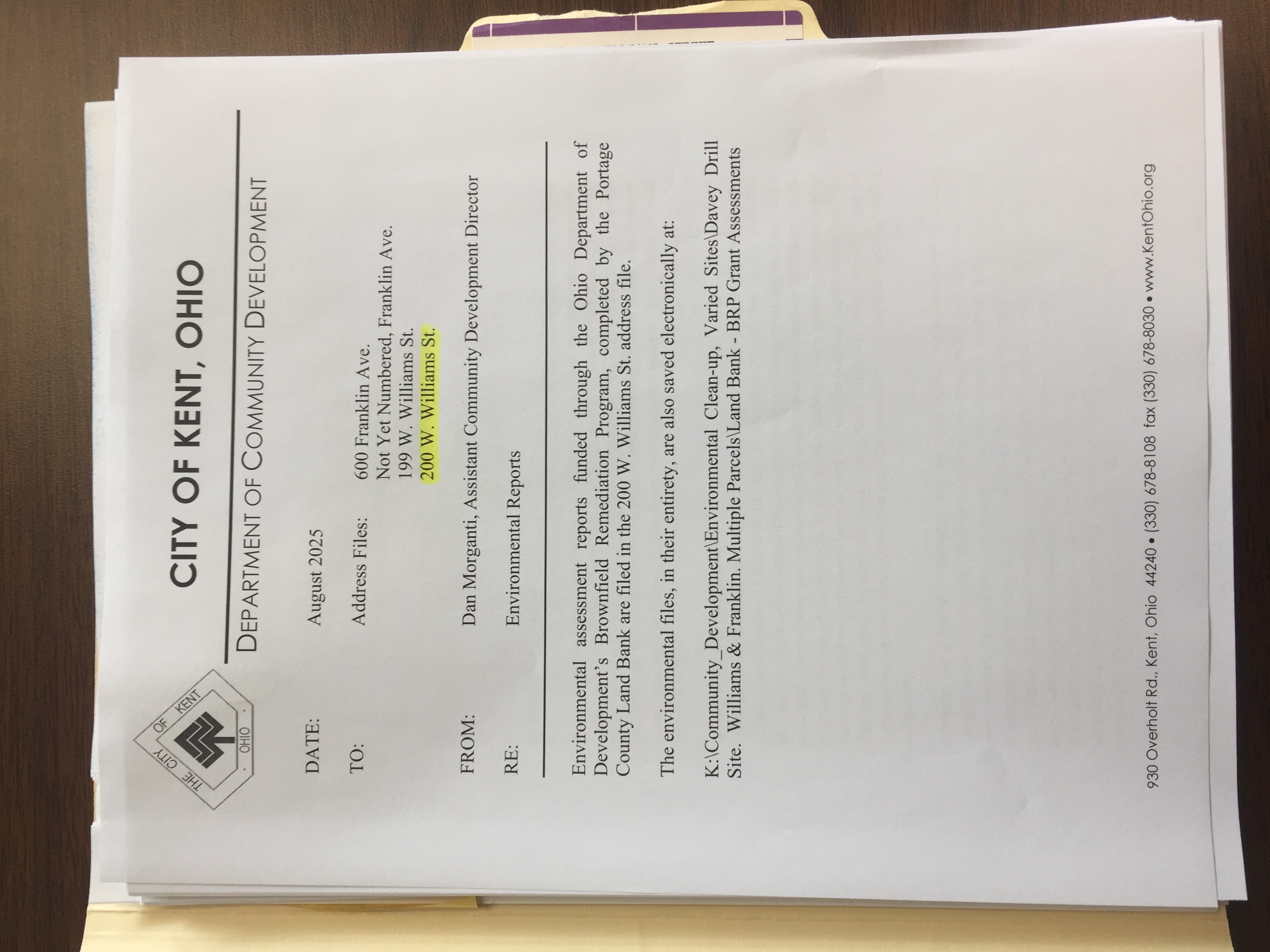
City of Kent Department of Community Development
RE: Environmental Reports cover page
8-2025
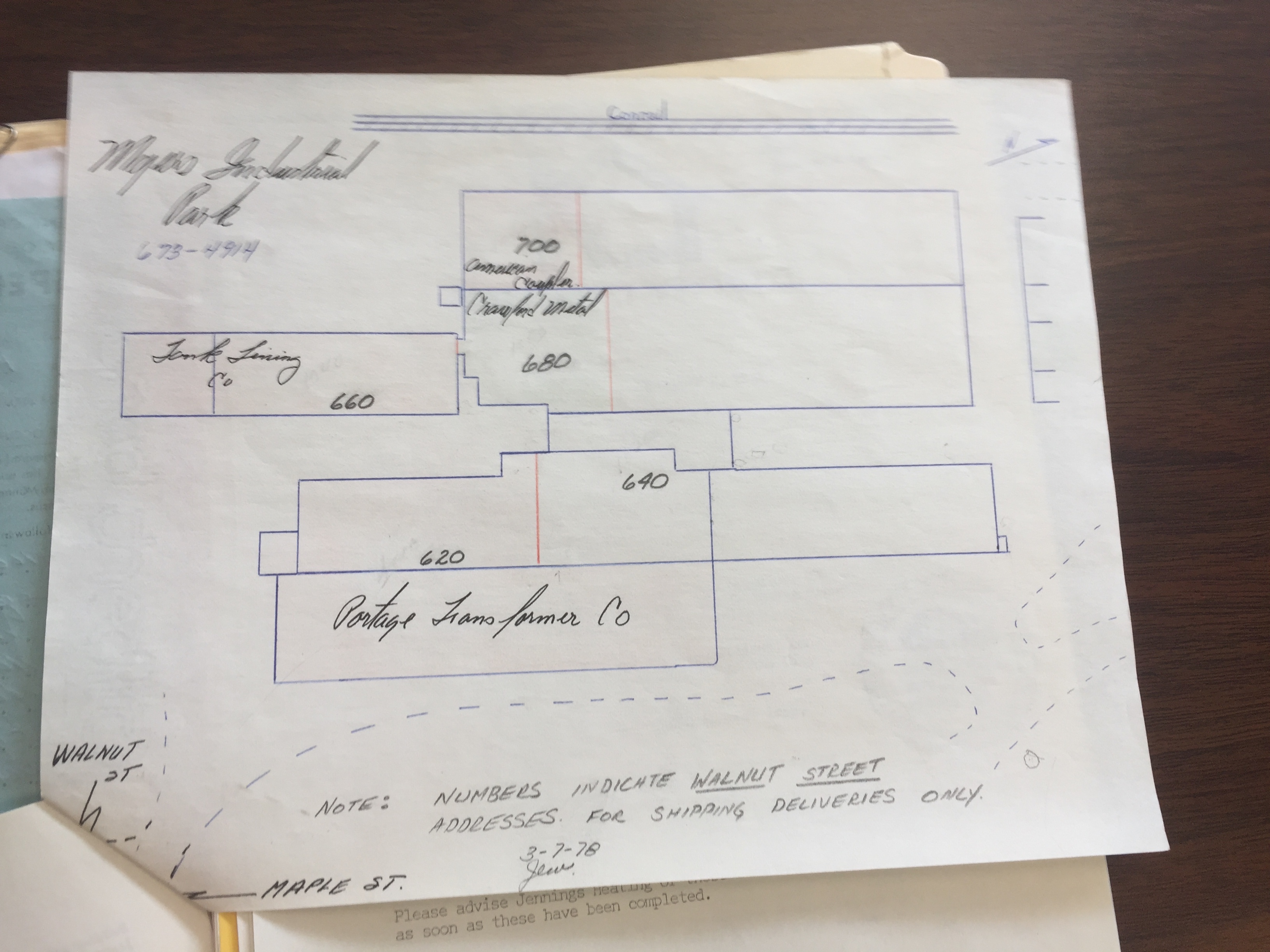
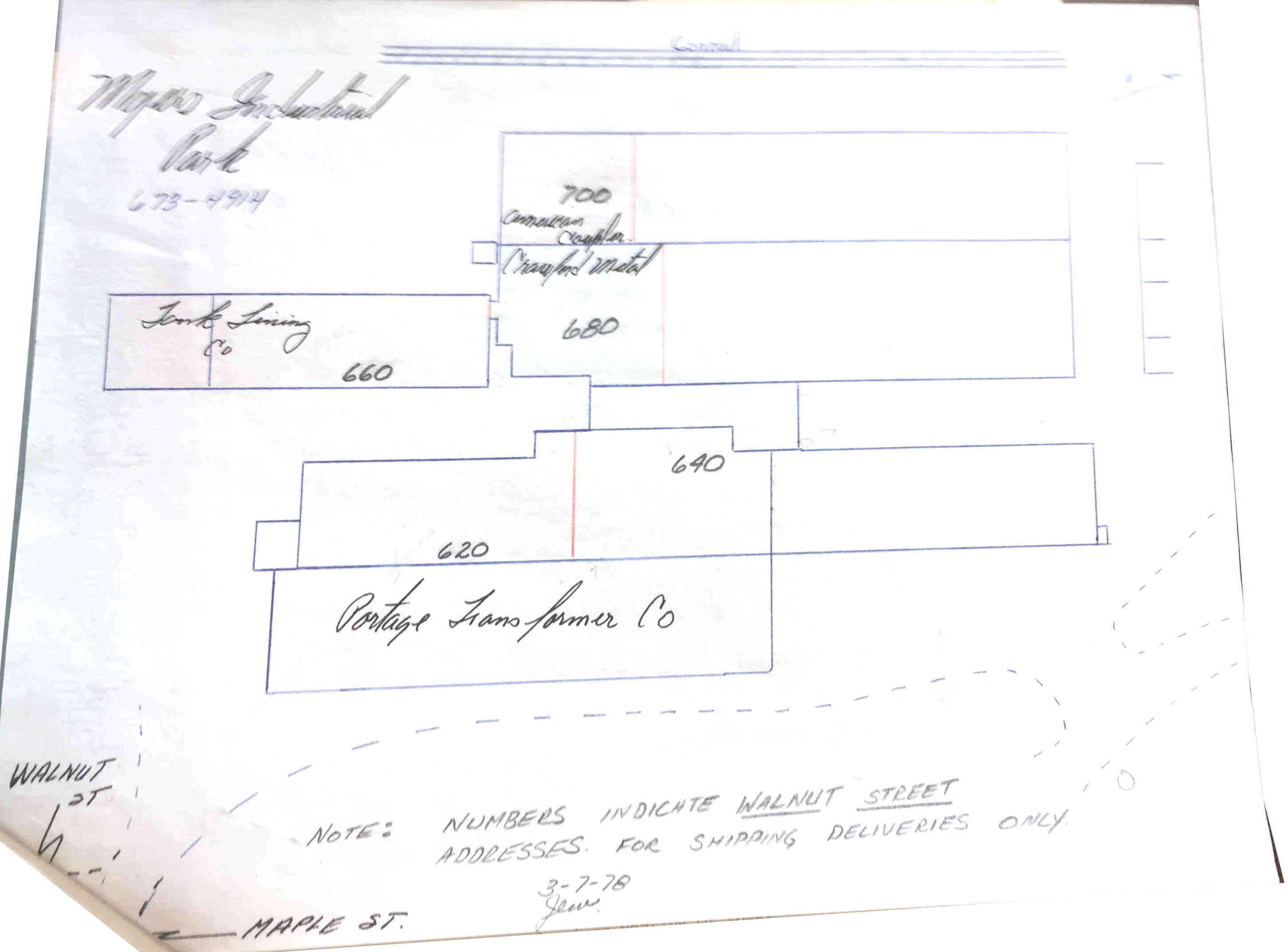
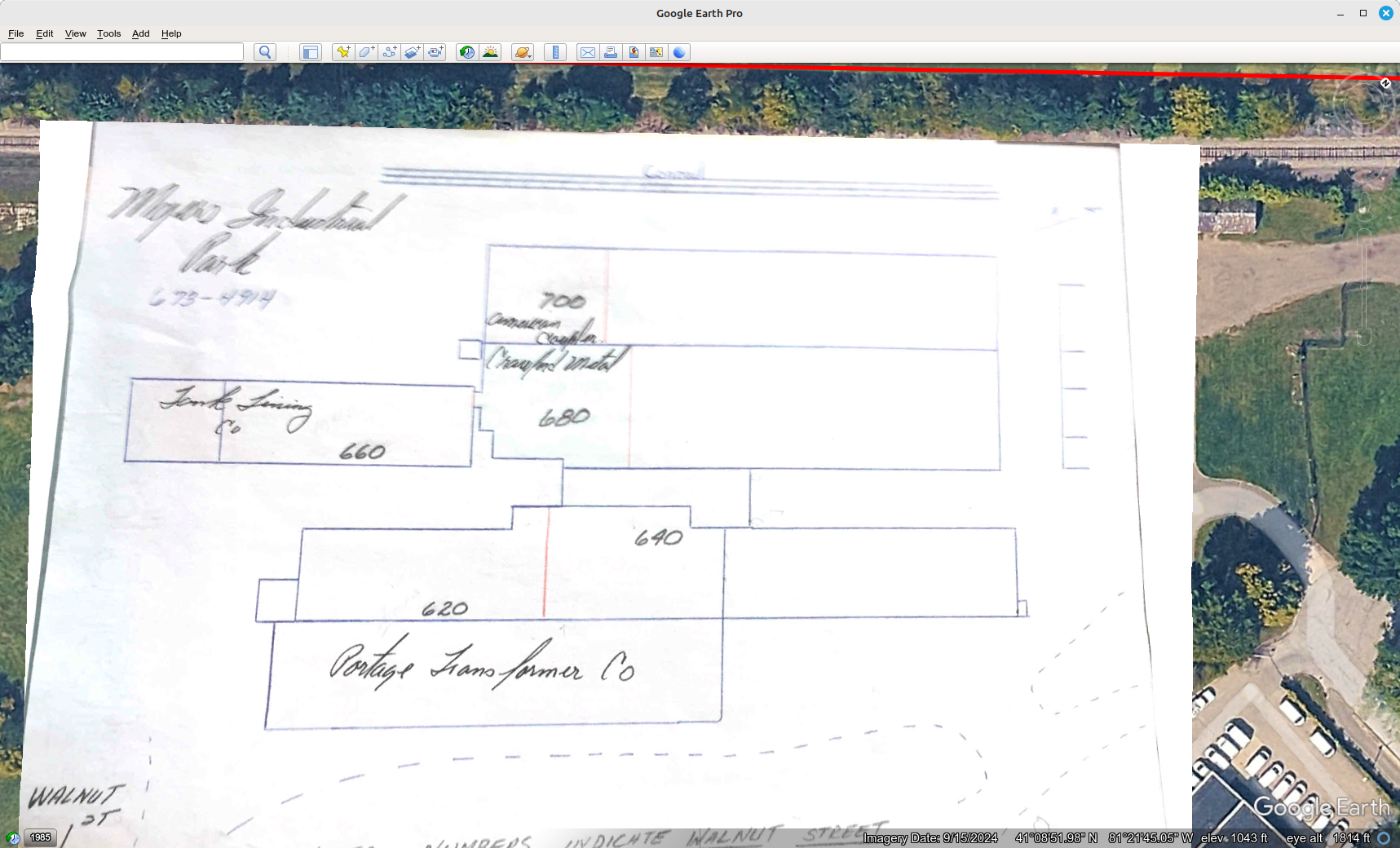
Myers Industrial Park
Diagram c.3-7-1978; Dagram cropped c.3-7-1978; Google Earth layer screenshot 4-2-2026
Kent Historical Society & Museum Collection
Revised 1919 Sanborn Fire Insurance Kent
Car Shops area map
KHS
Sanborn Kent Car Shops Map 1919.pdf
Ohio Department of Transportation Aerial Maps
Full and partial images
of the shops
Full sized images available at ODOT's .tif URLs
FLIGHT: 182
STRIP: 2
NEG: 14
IMAGE: 182-2-14.tif
DATE: November 7, 1948
COUNTIES: Portage
SCALE: 2,000.00
ALTITUDE: 12,000
https://tas.transportation.ohio.gov/Imagery/1940s/1948/182/182-2-14.tif
Partial
FLIGHT: 58
STRIP: 1
NEG: 10
IMAGE: 58-1-10.tif
DATE: May 3, 1949
COUNTIES: Summit, Portage
SCALE: 3,000.00
ALTITUDE: 18,000
https://tas.transportation.ohio.gov/Imagery/1940s/1949/58/58-1-10.tif
FLIGHT: 1,524
STRIP: 13
NEG: 541
IMAGE: 1524-13-541.tif
DATE: May 3, 1960
COUNTIES: Portage
SCALE: 800.00
ALTITUDE: 7,700
https://tas.transportation.ohio.gov/Imagery/1960s/1960/1524/1524-13-541.tif
FLIGHT: 2,339
STRIP: 2
NEG: 16
IMAGE: 2339-2-16.tif
DATE: September 6, 1962
COUNTIES: Portage
SCALE: 800.00
ALTITUDE: 7,600
https://tas.transportation.ohio.gov/Imagery/1960s/1962/2339/2339-2-16.tif
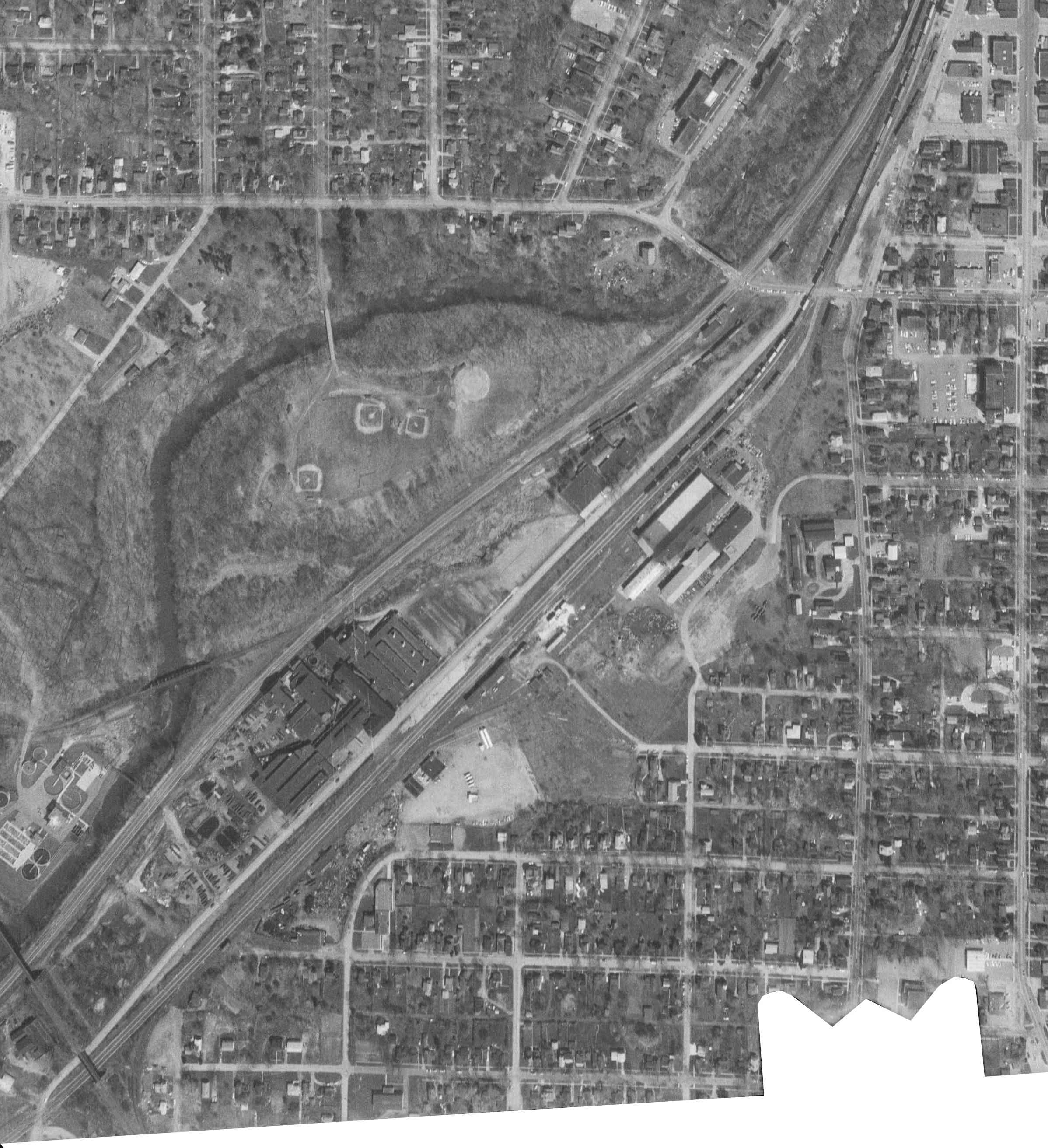
Partial
FLIGHT: 2,654
STRIP: 2
NEG: 30
IMAGE: 2654-2-30.tif
DATE: November 26, 1963
COUNTIES: Portage
SCALE: 200.00
ALTITUDE: 3,475
https://tas.transportation.ohio.gov/Imagery/1960s/1963/2654/2654-2-30.tif

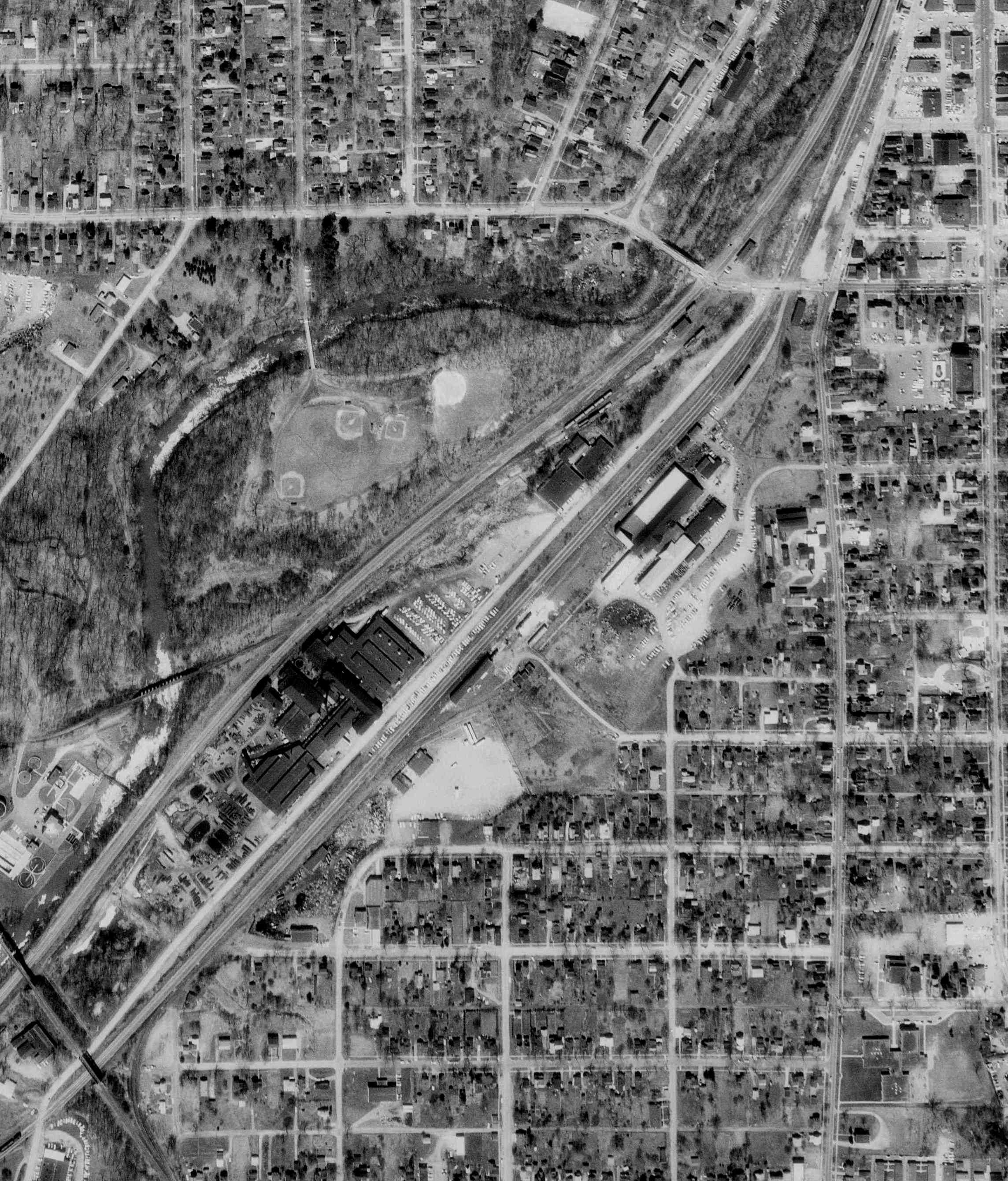
FLIGHT: 2,720
STRIP: 2
NEG: 17
IMAGE: 2720-2-17.tif
DATE: March 5, 1964
COUNTIES: Portage
SCALE: 200.00
ALTITUDE: 2,550
https://tas.transportation.ohio.gov/Imagery/1960s/1964/2720/2720-2-17.tif

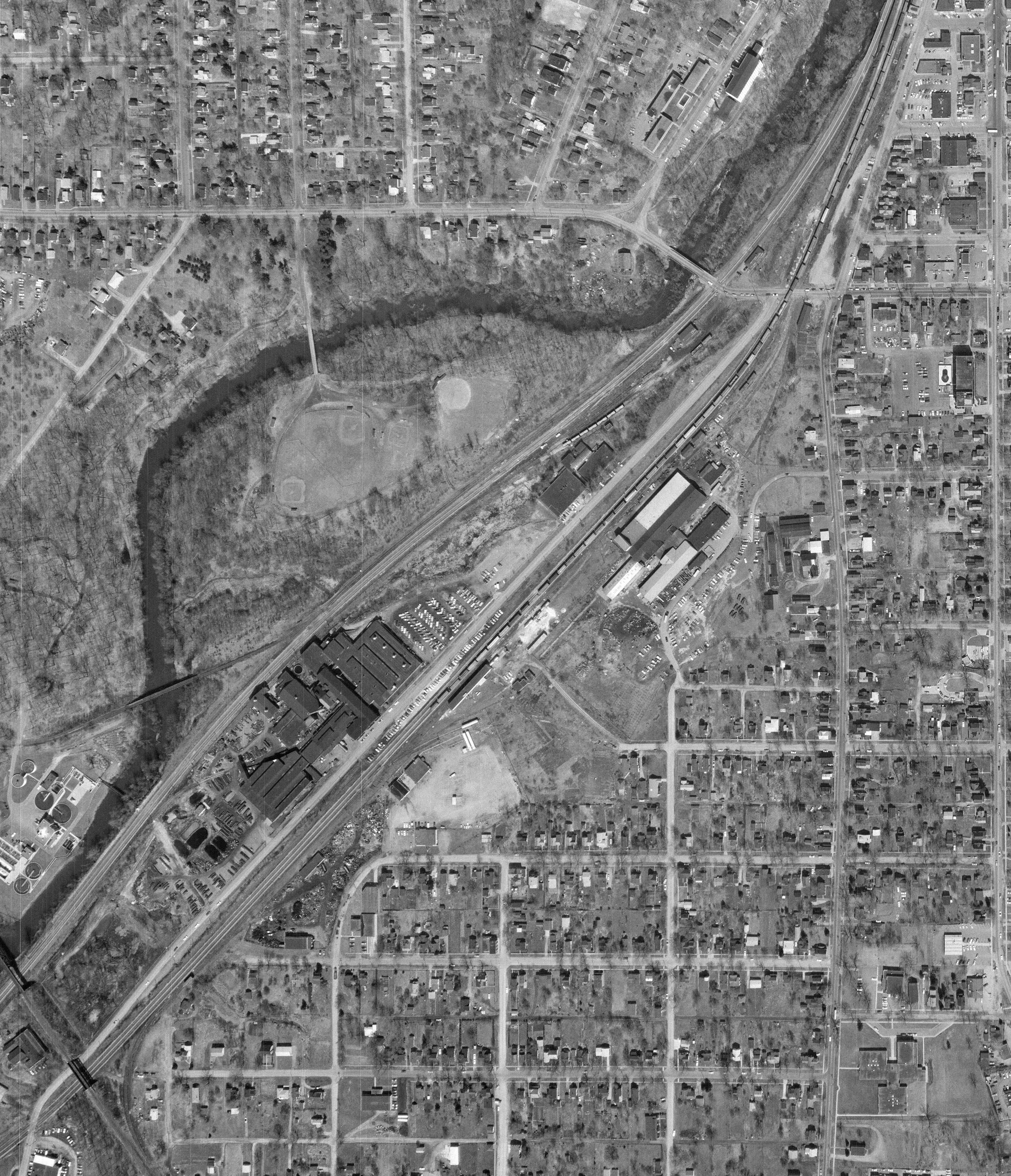
Partial
FLIGHT: 2,720
STRIP: 2
NEG: 18
IMAGE: 2720-2-18.tif
DATE: March 5, 1964
COUNTIES: Portage
SCALE: 200.00
ALTITUDE: 2,550
https://tas.transportation.ohio.gov/Imagery/1960s/1964/2720/2720-2-18.tif
FLIGHT: 146
STRIP: 3,203
NEG: 212
IMAGE: 146-3203-212.tif
DATE: April 25, 1970
COUNTIES: Portage
SCALE: 2,000.00
ALTITUDE:
https://tas.transportation.ohio.gov/Imagery/1970s/1970/146/146-3203-212.tif
FLIGHT: 32
STRIP: 211
NEG: 226
IMAGE: 32-211-226.tif
DATE: February 28, 1970
COUNTIES: Summit, Portage
SCALE: 2,000.00
ALTITUDE:
https://tas.transportation.ohio.gov/Imagery/1970s/1970/32/32-211-226.tif
FLIGHT: 7,906
STRIP: 15
NEG: 106
IMAGE: 7906-15-106.tif
DATE: March 10, 1970
COUNTIES: Portage
SCALE: 1,000.00
ALTITUDE: 7,000
https://tas.transportation.ohio.gov/Imagery/1970s/1970/7906/7906-15-106.tif
See Also
Kent Historical Society & Museum https://www.kentohiohistory.org
Back to NEOHRRHS Media
Page Updated 4-5-2026